Linda Nagata: the blog at Hahví.net


Archive for the 'Travel' Category

The Tongariro Alpine Crossing

Sunday, November 16th, 2014

Background: Ron and I arrived in Auckland on a cold spring day, when the sun was dueling with rain squalls that swept across the city at frequent intervals. I had a bad feeling about our upcoming hike. We were planning to do the Tongariro Alpine Crossing, a 12-mile day hike in Tongariro National Park. It’s one of the most popular day hikes in New Zealand, and described as “among the top ten single-day treks in the world.” But it wasn’t going to be a lot of fun if it involved constant rain, wind, or even snow. And in fact, snow fell the day before we arrived. But in an immense stroke of luck, the weather turned in our favor and we had an absolutely perfect day for hiking.

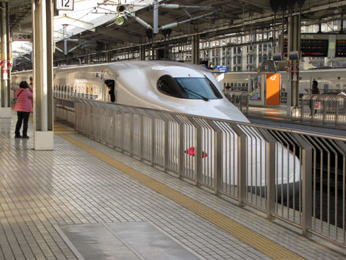
Logistics: we did not rent a car in New Zealand, for which, I believe, most Kiwis were grateful: American tourists unaccustomed to driving on the left side of the road evidently cause a lot of serious accidents. So we took a train — Kiwi Rail’s Northern Explorer — from Auckland to a little village called National Park, that’s just outside Tongariro National Park. We stayed at The Park Hotel at Ruapehu, which offered a hiking package. They picked us up at the train station and dropped us off at the trailhead early the next morning, along with a packed lunch. At the end of the day, they picked us up at the opposite end of the trail.

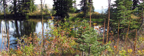
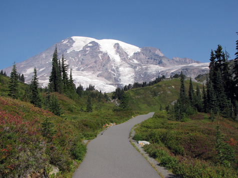
Geography: There are three active volcanoes in the center of Tongariro National Park. They are Ruapehu, Ngauruhoe, and Tongariro. The Crossing passes between Ngauruhoe and Tongariro over mostly volcanic terrain. The highest elevation is just over 6,000-feet. Here’s a map of the track.

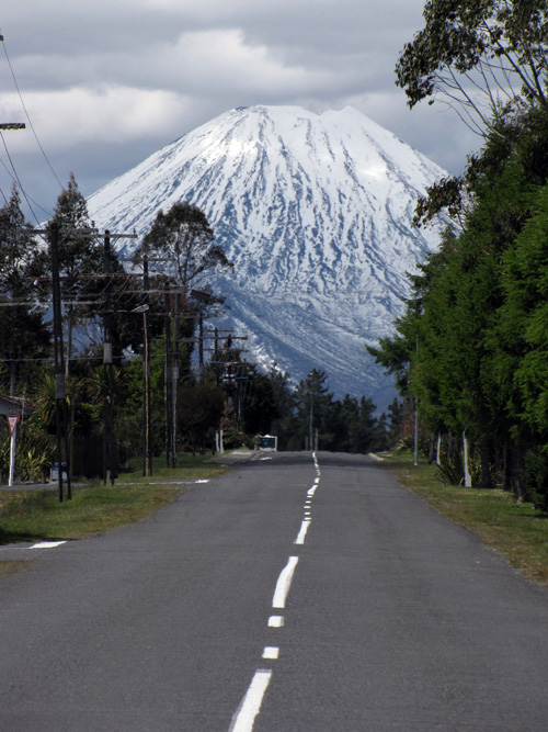
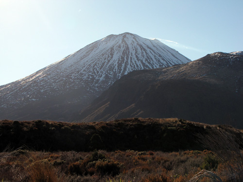
Here’s Mount Ngauruhoe on the day we arrived. How’s that for a classic volcano profile? Summit elevation is 7,516 feet. I call this shot “The Road to Mount Doom” since Ngauruhoe served as Mount Doom in the LOTR movies.
road_to_mount_doom

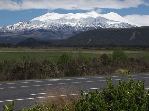
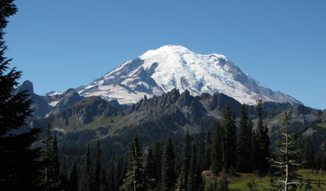
And this is Mount Ruapehu on the same day, a much larger and taller mountain, standing at 9,177 feet.
Mt_Ruapehu_500px

(more…)

How Not To Plan A Trip

Saturday, November 15th, 2014

Ngauruhoe_early_morning_500pxRon and I returned from a ten-day trip to New Zealand today — our first visit to Aotearoa. The trip was a little ironic for me because I’ve been wanting to visit New Zealand for thirty years — but despite all that potential prep time this was a very last-minute affair.

Here’s the guilty admission: we’ve found that the only way we ever get it together to plan a trip is to buy the airline tickets first. Since the tickets are nonrefundable, we are then forced to sit down and plan things to do, or all the money spent on the tickets will go to waste. So several months ago we decided that we were going to fly to Auckland. Hawaiian Airlines has good rates and the flight from Honolulu only takes eight to eight and a half hours. The other advantage for us is that Hawaii and New Zealand time zones differ by only one hour — oh, and one day! Kiwis are nearly the first to greet a new day, and here in Hawaii we are nearly the last.

So we purchased our tickets and then…did no planning, nothing at all, for weeks. And weeks.

What can I say? We both get caught up in our day-to-day work, and we’ve both been extremely busy, but suddenly we had only about three weeks left before the trip. It was time to get serious. So we patched together a fairly simple itinerary, staying on North Island and splitting our time between Auckland and Tongariro National Park.

As those of you who visit my blog regularly know, I love to hike, and we did three truly amazing hikes while in NZ. I want to write about those over the next few days. We are thinking of visiting South Island next year, so if you have great hikes to recommend in that region please let me know!

More soon…

Rainier National Park: Lakes Trail

Friday, September 26th, 2014

A pond on Lakes Trail

Ron and I visited Rainier National Park this past weekend. The last post talks about our hike to the lower glaciers along Skyline Trail on a blazingly hot Sunday. By contrast, on Monday morning we woke up to a light rain. This was a more familiar face of Rainier — but neither of us wanted to hike in the rain, so we wondered if we should stay. We were paying a lot for our hotel room and there is no TV, no Internet, no cell phone communication in the park. If the day turned out to be too wet to go hiking, I resolved that we would just check out a day early.

But by 10:30am the clouds broke up and the sky turned blue, so the hike was on!

This day was considerably cooler, but it was not cold. Late morning through early afternoon was sunny, but by late afternoon clouds had returned and I expected to get wet — but then the clouds broke up again. So once more, we were incredibly lucky with the weather.

We weren’t quite as lucky with the trail. The Lakes Trail drops down below the visitor center to Reflection Lake, but there are two branches to the trail. The shorter one turned out to be closed because of ongoing repairs on a road that the trail crosses. So instead of hiking down, we started off hiking up above the visitor center on the same trail we’d taken the day before, to a junction with Lakes Trail, where we began our descent. This trail provided a very different experience from the day before, as we traversed meadows and passed through groves of evergreens. Along the way there were a couple of incredible view points, one of Steven’s Canyon, and the other from Faraway Rock.

Once we reached the bottom, we crossed the road and started up again, this time aiming to reach Pinnacle Peak, which we did in the early afternoon. We then turned around and hiked back down to the road, and then up again, to Paradise Inn. Total mileage for the day was 10.8 miles.
(more…)

Rainier National Park: Skyline Trail

Thursday, September 25th, 2014
Just inside the park entrance at Chinook Pass/ Cayuse Pass

Just inside the park entrance at Chinook Pass/ Cayuse Pass, September 20, 2014

Ron and I just got back from a ten-day trip to the state of Washington. We did a lot of sightseeing, including three nights at Paradise Inn — the only hotel in the park, located very close to the visitor center. This was the third time we’d been to Rainier. The first time, there was still a lot of snow on the ground, so we just drove around and had only occasional views of the mountain. The second time, the weather was rainy, there was ice in the parking lots, it was late fall so the visitor center was closed, and except for a brief glimpse, we didn’t see the mountain until we were driving away. But this time the weather was amazing!

The clearest day was the day we arrived. The sky was a stunning blue. But since we arrived late in the day, we didn’t do any hiking. The following day, Sunday, was incredibly hot — hot, at Mount Rainier! — I could hardly believe it. There wasn’t a cloud in the sky until very late in the day, but there was a brown haze, so it wasn’t quite as clear as the previous afternoon. I’m not complaining, though! We were incredibly fortunate.

I was concerned that the weather might turn wet by the next day so, prioritizing what we wanted to see — glaciers! — we set off from the Visitor Center, heading up Skyline Trail. We took the right branch of this loop trail so that we could venture directly to Paradise Glacier Trail. Skyline starts off paved on both branches, but gets a little rougher later on, especially after branching off to the glacier trail. Overall, though, trails were excellent all over, with just a few places suffering erosion. This being a gorgeous weekend, trails were also full of people out to enjoy the day.

We hiked a total of 8.7 miles, getting as high as the ridge alongside Pebble Creek. We didn’t try to hike up any further. If we had, we would have been crossing Nisqually Glacier below Camp Muir. The camp, I believe, is a staging area for those going to the summit.

The worst part of this hike, oddly enough, was the asphalt trail at the base, directly above the visitor center. This is the left branch of the loop trail, and was so incredibly steep that it was painful to descend after a full day of hiking.

Here’s the nicely paved start of the right-hand branch of Skyline Trail:
Beginning of Skyline Trail, the right hand branch of the loop
(more…)

Revisiting Yosemite (with bears!)

Friday, May 23rd, 2014

I lived for my first nine or ten years in California, and for most of that time my dad and mom were into car camping — and so was I! We would take off for a weekend or a week to visit parks and forests in the deserts and mountains. I loved it. I don’t remember ever being unhappy when I heard we were going camping.

More than one of those visits was made to Yosemite National Park. This would have been in the 1960s. We moved to Hawaii around 1970, and I don’t think I ever visited the park again — that is, until now. This past week, after the Nebula awards, I made it back to the park for one glorious day. I was with my husband, who was seeing the park for the first time. The weather was perfect, and the crowds were not bad at all.

upper_valley_from_Glacier_Point

We started with a visit to Glacier Point, where we had a stunning, panoramic view. We also discovered there is a trail, just over four miles in length, that traverses the valley wall between Glacier Point and the valley floor. That is definitely on our list to do the next time we’re able to visit.
(more…)

Illiteracy & Scribbling

Sunday, December 15th, 2013

Most large tourist sites in the USA offer at least some information in multiple languages. The same is true in Japan. English is the most common option there, with Korean and Chinese offered where there are a lot of tourists. It’s very reassuring to hear an English announcement of an upcoming destination when riding a train or a bus! And many signs are written in both Roman and Kanji, making life far easier for an American traveler like me who does not speak or read Japanese.

But not everything is available in English — not by a long way. So for me, traveling in Japan is an experience of effective illiteracy. Often, I cannot read even basic information. This makes it very difficult to know what’s up, what is possible, what is available, or where to go — and really drives home the importance of literacy for everyone in the modern world.

On the other hand, many businesses in Japan do have English names — although these names often don’t make sense to an English speaker. I take this as a warning to writers (like me!) who occasionally employ foreign words and phrases from languages we don’t speak. Caution is called for! But on the positive side, the results can be quite humorous. At the end of a long day, we ran across this sign, randomly placed beside a garden on the grounds of a castle in Kyoto:
no_scribbling_sign
But if we cannot scribble here, than where shall we scribble?

After a bit of laughter and debate, we decided this probably meant “No graffiti,” though even that left us puzzled, because there was nowhere to write except on the sign itself. And of course, in our perverse American way, being told not to do something that it had never occurred to us to do, made us wonder if maybe we ought to…

But no! Of course we didn’t scribble. But it made for a good photo op.

Later we were told that graffiti is considered a real problem. I saw a few “tags” while we were there, but if graffiti is a problem, to this casual observer it seems to be a problem under control.

Japan In Late Fall

Saturday, December 14th, 2013

Last spring we made our first visit to Japan, arriving in Fukuoka at the height of cherry blossom season. It was a terrific trip, and my husband and daughter were soon plotting a return that would let us view the fall foliage. We’ve just returned from that adventure, and it too was a success.

The Internet decreed that early December would be the peak of the fall foliage season in southern Japan, so we set our trip for that time — though December seemed very late in the year to me. As it turned out, we were probably two weeks past the peak of the maple foliage season. Nevertheless, there was still a lot of color and many spectacular sights. The advantage of our late arrival? Far smaller crowds than we would have faced only a week or two earlier.

We did most of our in-country traveling on the Shinkansen, taking the train from Fukuoka to Kyoto, and then Kyoto to Kumamoto via Himeji. The Shinkansen is awesome, and a joy to ride, although views are limited because much of the track in southern Japan passes through tunnels, or between walls that I presume are noise buffers.

Kyoto has a historic district with traditional streets and buildings, that house many small shops and restaurants. Shrines and gardens are everywhere. This is one of the brightest Japanese maples we saw, thriving in a Kyoto park:
maple_tree_at_Kyoto_park
(more…)

Fukuoka, Japan!

Saturday, April 27th, 2013

Sakura tree in Fukuoka
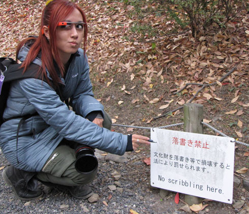
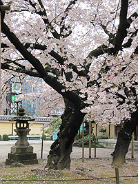
I had the good fortune this spring to visit Japan. My husband’s grandparents emigrated from Kumamoto prefecture in southern Japan. Ron and I had long intended to visit the region, but we kept putting off the trip year after year for the usual reasons of time and money and language issues. Neither of us speaks any Japanese. But last fall it occurred to us “If not now, when?” So we sat down with our daughter (who does speak a little Japanese) and son-in-law and booked our flight to Fukuoka, which is a large city just a short train-ride away from Kumamoto. We chose to go the week that the University of Hawaii takes spring break in the hope that our son could come along too. As it turned out, my son couldn’t make it, but our timing was exquisite, because we stepped off the plane to find ourselves at the peak of cherry blossom season. We couldn’t have planned it better if we’d tried. Actually, if we’d tried, I’m sure we wouldn’t have done nearly so well, because the season was predicted to peak a week later.
(more…)