


Ka`u Trail / Footprints
Monday, August 4th, 2014The day after our Hilina Pali hike, we dialed things back and went on two short hikes, instead of one long, challenging one…with a visit to a winery in between.
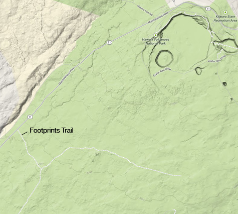
The hike that was new for us was the “footprints” trail. It starts on Mamalahoa Highway. There’s no parking lot, just a pullout alongside the uphill-bound lane. Keep a sharp eye out for it — the trailhead is very easy to drive past, especially given the speed of traffic on this section of the road. But once you find the right place to stop, the trail is easy to follow.
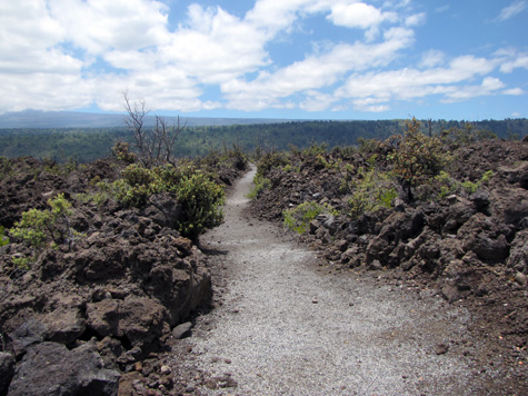
This is an easy hike. It’s short, there’s very little elevation change, and trail conditions are mostly good. In fact, part of the trail is paved with asphalt. I think this is leftover from the days of long ago when the National Park Service had better funding.
This is called the “Footprints Trail” because at different times in past centuries, people walked through this area during severe volcanic activity, leaving footprints behind in thin layers of clay. The park service built a shelter over an example of footprints, but over the years the prints have been vandalized and aren’t really recognizable. Nevertheless, this is a great hike to see the old lava flows and the sparse vegetation on this side of the area known as the Ka`u Desert. Highly recommended if you want a short outing!
Note that the Footprints Trail meets the Ka`u Desert Trail, which runs for miles in both directions. You might want to continue on for a bit — but don’t get carried away.
And that winery? It’s Volcano Winery, of course! We liked the guava-grape wine.
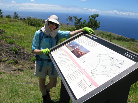
This is near the start of the Footprints Trail.
(more…)