The Tongariro Alpine Crossing
Sunday, November 16th, 2014Background: Ron and I arrived in Auckland on a cold spring day, when the sun was dueling with rain squalls that swept across the city at frequent intervals. I had a bad feeling about our upcoming hike. We were planning to do the Tongariro Alpine Crossing, a 12-mile day hike in Tongariro National Park. It’s one of the most popular day hikes in New Zealand, and described as “among the top ten single-day treks in the world.” But it wasn’t going to be a lot of fun if it involved constant rain, wind, or even snow. And in fact, snow fell the day before we arrived. But in an immense stroke of luck, the weather turned in our favor and we had an absolutely perfect day for hiking.
Logistics: we did not rent a car in New Zealand, for which, I believe, most Kiwis were grateful: American tourists unaccustomed to driving on the left side of the road evidently cause a lot of serious accidents. So we took a train — Kiwi Rail’s Northern Explorer — from Auckland to a little village called National Park, that’s just outside Tongariro National Park. We stayed at The Park Hotel at Ruapehu, which offered a hiking package. They picked us up at the train station and dropped us off at the trailhead early the next morning, along with a packed lunch. At the end of the day, they picked us up at the opposite end of the trail.
Geography: There are three active volcanoes in the center of Tongariro National Park. They are Ruapehu, Ngauruhoe, and Tongariro. The Crossing passes between Ngauruhoe and Tongariro over mostly volcanic terrain. The highest elevation is just over 6,000-feet. Here’s a map of the track.
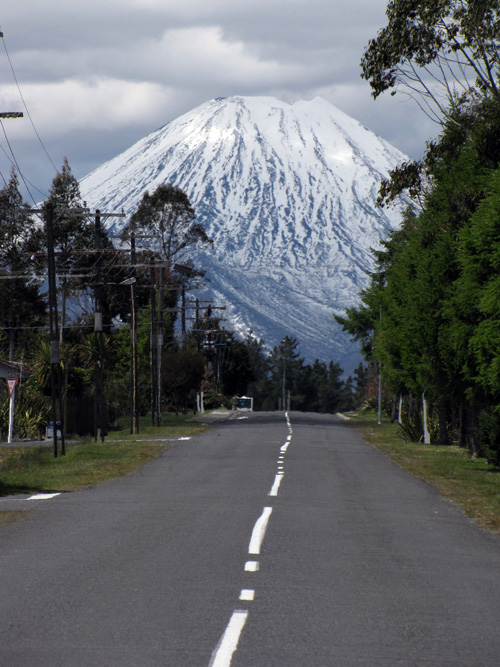
Here’s Mount Ngauruhoe on the day we arrived. How’s that for a classic volcano profile? Summit elevation is 7,516 feet. I call this shot “The Road to Mount Doom” since Ngauruhoe served as Mount Doom in the LOTR movies.

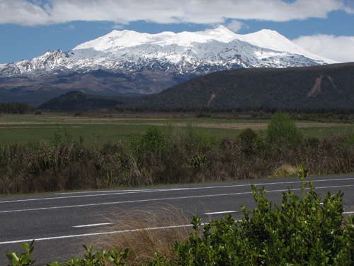
And this is Mount Ruapehu on the same day, a much larger and taller mountain, standing at 9,177 feet.


