


The Tongariro Alpine Crossing
November 16th, 2014Background: Ron and I arrived in Auckland on a cold spring day, when the sun was dueling with rain squalls that swept across the city at frequent intervals. I had a bad feeling about our upcoming hike. We were planning to do the Tongariro Alpine Crossing, a 12-mile day hike in Tongariro National Park. It’s one of the most popular day hikes in New Zealand, and described as “among the top ten single-day treks in the world.” But it wasn’t going to be a lot of fun if it involved constant rain, wind, or even snow. And in fact, snow fell the day before we arrived. But in an immense stroke of luck, the weather turned in our favor and we had an absolutely perfect day for hiking.
Logistics: we did not rent a car in New Zealand, for which, I believe, most Kiwis were grateful: American tourists unaccustomed to driving on the left side of the road evidently cause a lot of serious accidents. So we took a train — Kiwi Rail’s Northern Explorer — from Auckland to a little village called National Park, that’s just outside Tongariro National Park. We stayed at The Park Hotel at Ruapehu, which offered a hiking package. They picked us up at the train station and dropped us off at the trailhead early the next morning, along with a packed lunch. At the end of the day, they picked us up at the opposite end of the trail.
Geography: There are three active volcanoes in the center of Tongariro National Park. They are Ruapehu, Ngauruhoe, and Tongariro. The Crossing passes between Ngauruhoe and Tongariro over mostly volcanic terrain. The highest elevation is just over 6,000-feet. Here’s a map of the track.
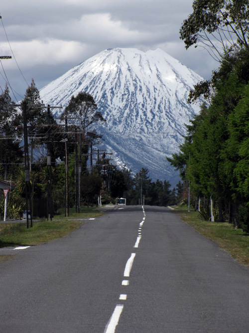
Here’s Mount Ngauruhoe on the day we arrived. How’s that for a classic volcano profile? Summit elevation is 7,516 feet. I call this shot “The Road to Mount Doom” since Ngauruhoe served as Mount Doom in the LOTR movies.
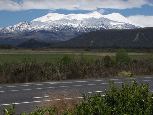
And this is Mount Ruapehu on the same day, a much larger and taller mountain, standing at 9,177 feet.
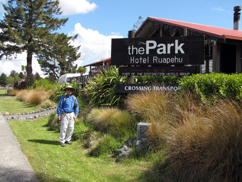
Our accommodations: The Park Hotel at Ruapehu. The staff was terrific, the grounds were beautiful, and the rooms were basic but comfortable. They have backpacker accommodations, but we took a private room. I would definitely stay here again.
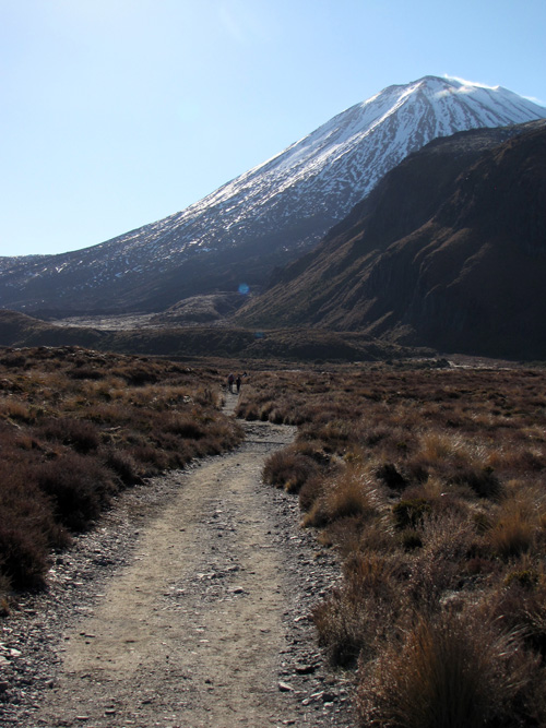
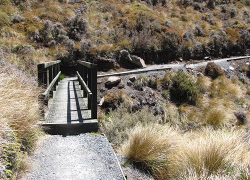
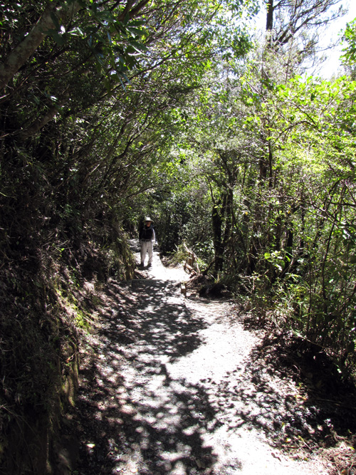
The van to the trailhead left the hotel at 7:30am. The van driver provided a short but very useful summary of the hike, and then we set out at 8:10am — an unheard of early start for us! The beginning of the trail is a gradual ascent along a gravel and boardwalk track, and is absolutely beautiful.
In the USA we call it a trail, but in NZ it’s a track. The track climbs steeply after the Soda Springs junction, including sections of stairs. Click the photo to see a larger version, and check out the number of hikers on the track. Hundreds of people were making the crossing on this weekend day. Despite the heavy use, the track is in fantastic condition. I’ve never seen a better maintained trail. We have nothing like it in Hawaii.
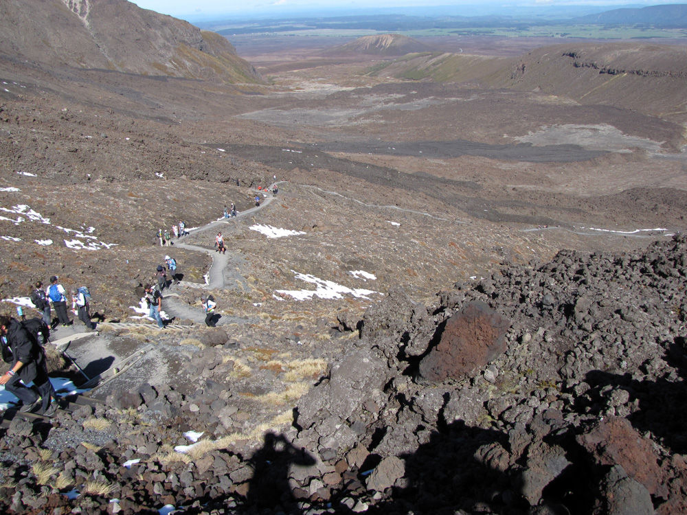
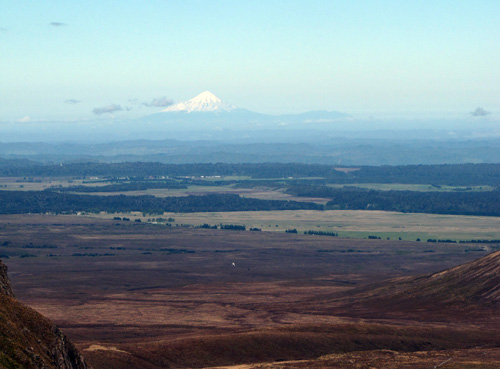
At the top of the first steep ascent we were able to look out across the landscape to a distant volcano; I have to look up the name, but I believe it’s supposed to be about eighty kilometers away. Update: @SoonLeeNZ informs me this is Mount Taranaki. My husband also looked up the name and the distance: 136 kilometers or 85 miles.
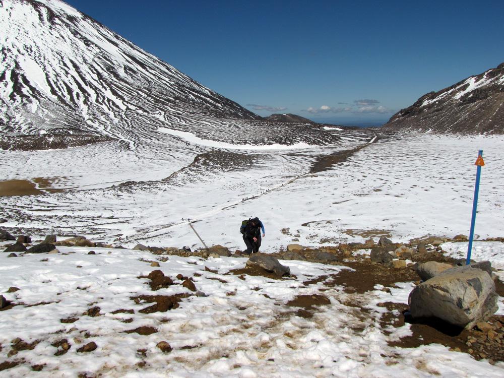
Snow had fallen two days earlier, and despite the sunshine it was melting only slowly. We managed to keep our boots dry skirting Mount Ngauruhoe and made short work of the next quick ascent. Again, click the photo to see a larger version. There were quite a few people on the track.
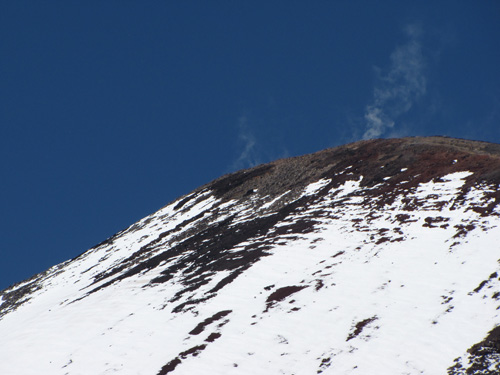
I mentioned that Ngauruhoe is an active volcano…yes, there is steam coming from the top.
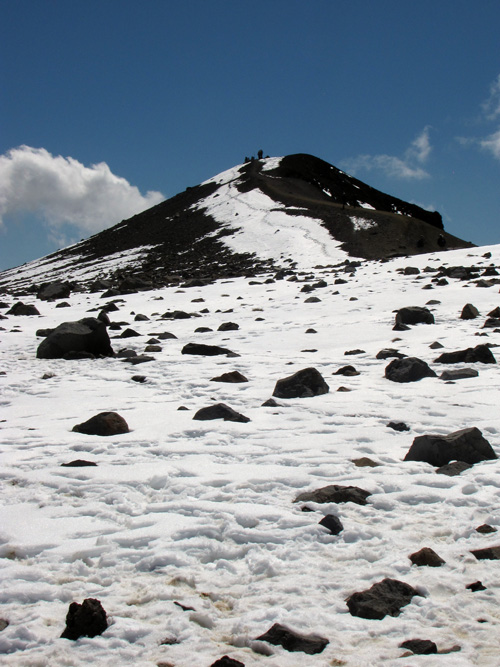
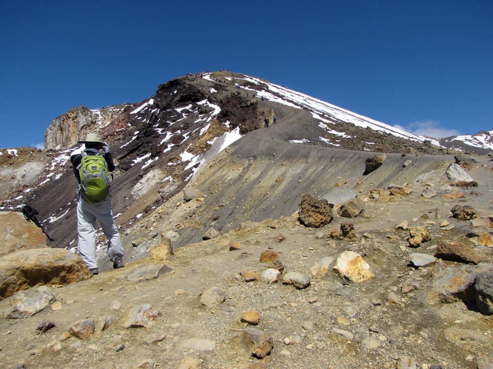
This is the climb to Red Crater, the highest point on the trail:
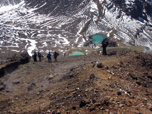
Here we’re looking down from the high point to the Emerald Lakes below. There’s a bit of steam seeping from the cut to the left of the trail, and a strong sulfur smell. The short stretch from here to the Emerald Lakes is loose cinder, and is among the worst sections of this incredibly well-maintained track. Yes, I slipped and fell! I’m really surprised that the erosion here isn’t worse. By the way, I haven’t mentioned it before, but trekking poles are HIGHLY RECOMMENDED on this hike.
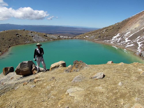
And here’s a closer look at one of the Emerald Lakes. The water is not warm, but it’s not cold either. I’m curious if these lakes ever freeze. I suspect they don’t, but I haven’t researched it yet.
This is Blue Lake, which sits up above lower ground in its own crater. Again, I’m curious: does it ever freeze? We had lunch over there by Blue Lake (away from the sulfur fumes). While we were eating some kids who were also taking a break had fun with a snowball fight.
Here we’re looking at the last climb before beginning the descent. Click the image to see just how many people there are.
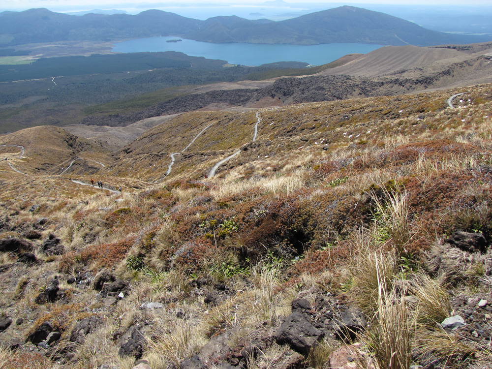
And we are on the other side! Click to see a larger version showing the switchbacks in this amazing trail as it descends through alpine shrubland.
I am continuously amazed at the wonderful engineering on this trail.
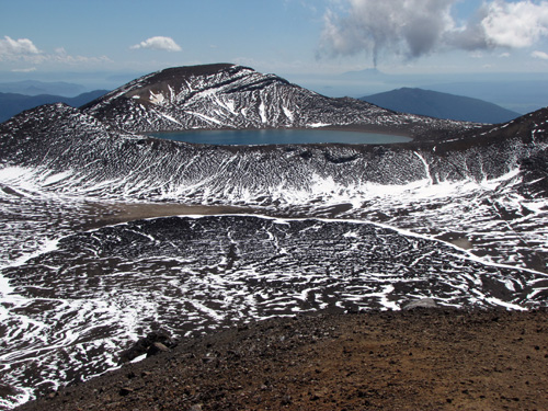
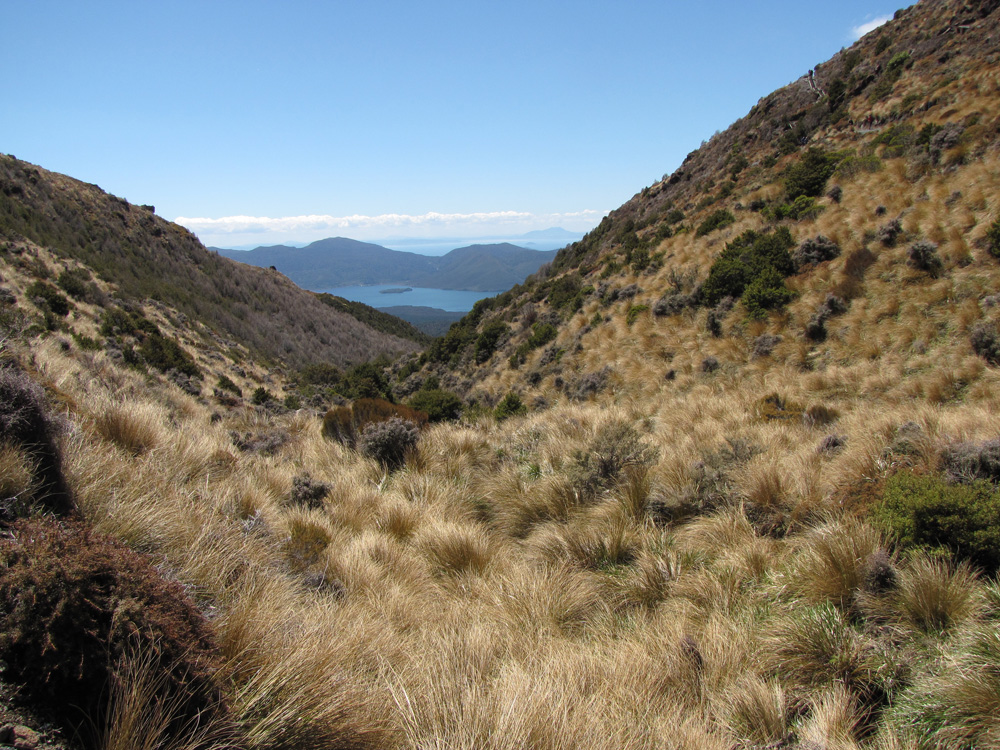
Another view of the lakes in the region.
I had initially been worried about encountering bad weather on this trek, but as we descended the day became hot, so it was a relief to enjoy the shade of a forest for the last few miles.
And here is the very busy car park at the end of the track. This was a long hike, 12 miles. It took us about six and half hours to do — much faster than I would have predicted, but that was due to the wonderful trail conditions.
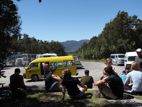
As we waited for our ride I watched a lot of people reach the end of the trail. They all seemed to be having a good time, and not everyone looked like an athlete, nor were they all young. Still, do not underestimate this trail. We passed a few people who had, or who had overestimated their own abilities, and I’m sure they were not smiling when they got out. Hiking poles, good boots, and layered clothing are all necessities, along with rain gear. We were extremely lucky with perfect weather, but on the next day, the mountain was covered in clouds, so you never know.
Conclusion: The Tongariro Alpine Crossing is an amazing hike. Highly recommended.
Posted on: Sunday, November 16th, 2014 at 11:15 am
Categories: Hiking, Travel.
Tags: New Zealand, North Island, The Tongariro Crossing
November 16th, 2014 at 12:12 pm
What a terrific hike! Glad you had such excellent weather, too.
November 16th, 2014 at 1:25 pm
wow, what beautiful terrain! Thanks, Linda!